Wednesday
May 3, 2005
Bellhaven, North Carolina
Arrived here after a long day trip from pretty Beaufort, N.C.( pronounced as bow-fort as different from Beaufort S.C. pronounced as beu-fort ) travelling a distance away from the notorious Cape Hatteras. This Cape eats boats and spits them up on the rocks like mellon seeds. So as to stay in safe waters and not be snack food we took the ICW. We cruise canals, back rivers, ditchs and across Pamlico River, a large body of water more like a Sound to continue on back into the safe area again called Pungo River. We had left at 9:15 A.M. to arrive at 5:00 P.M. A long day but good weather and small roll.
Now, before getting to Beaufort N.C. we enjoyed the southern city of Charlston S.C. The houses are old and have many nice gardens including the churchs also. There is much more to say about southern living and this cities history but another time. Of interest also was the small port of Surf City. Sleepy little town waiting for the summer crowds. The beach had polished stones and nice shells including finding a small sharks tooth. Local history story tellers have it that a German sub was sunk just off shore in 42’ and 33 sailors taken as prisoners, many of the crew went down with the ship These were the first prisoners of war to be interned in the US since 1812. Guess that makes the sub and her crew another type of food for Posieden and Cape Hatteras, The Crystal Coast.
Now we will be headed for Elizabeth City and the Dismal Swamp Canal and Locks.
Must mention the seafood has not stopped being incredible. Soon we’ll try a roast of beef just to make a change of menu. Eat your heart out Cape Hatteras. Eh!
Loopers on the return.
Ted, Pat, David and Susan
NEW BOOK!

Boating Ahoy!
VIDA_GLASS TRAYS by TED

VIDA FASHION MATS

Georgian Bay Shadows

Georgian Bay Waters Edge

2018 Day trip to the outside island
Fall Carpet
Georgian Bay comes alive
salt spring island shores

48˚ 55' 20.98" N 123˚ 33' 07.82" W
VIDA Fashion Statement Bags

good quality with unique styling
VIDA FASHIONS by Ted

New Statement Bags
aluminum art images

cars and flowers
Georgian Bay near McCrae Lake

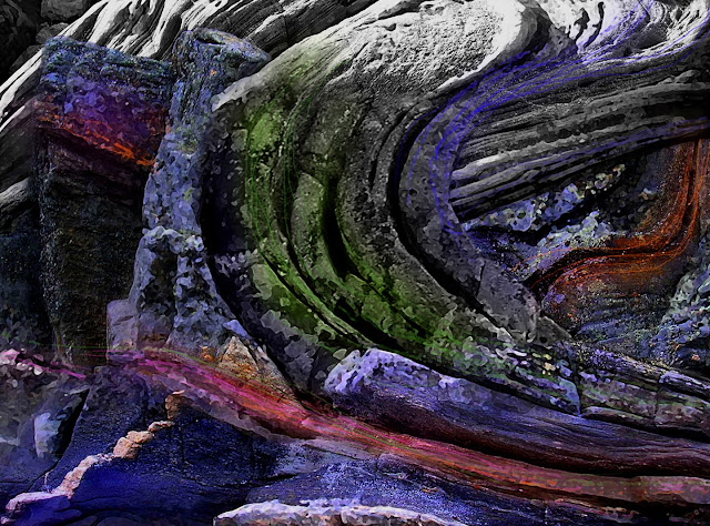
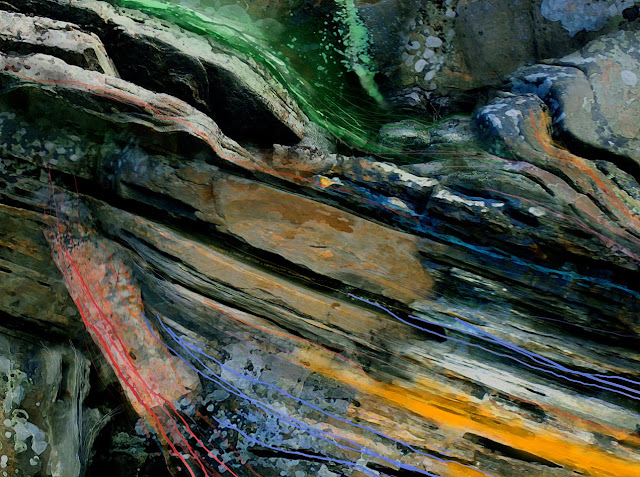
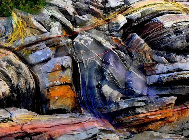
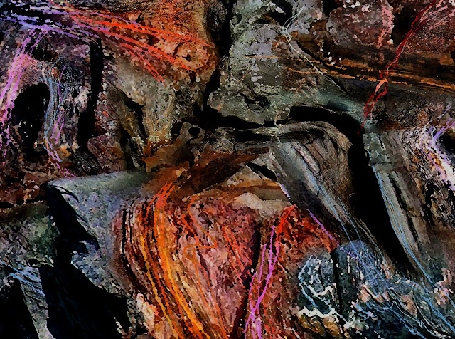
Sourcing the power of their formations
VIDA Fashions by Ted

more of the collection
VIDA Fashions by Ted

Georgian Bay Shoreline Rocks are Wearable
Fashions by Ted

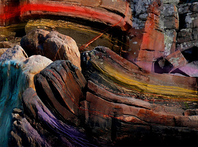
Beautiful Rock and Auto Colours
VIDA fashions by Ted

Georgian Bay Rock Paint Palletts
VIDA FASHIONS by TED

VIDA PILLOW FASHIONS by TED

rock solid pillow talk
Killarney August 2015 "Waters Rising"

West Shore Lambert Is.

44˚ 55' 10. 98" N 79˚ 52' 25. 61" W
Little Pine

44˚ 55' 34 . 83" N 79˚ 50' 23 . 64" W
Lambert Island Channel

Georgian Bay Rocks on

Monument Channel Area

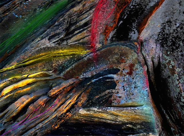
turning up the heat
Caribbean Coral Rocks

GB rocks on

ROCKS TO ART

2014_Maxwell Island, Georgian Bay
Haida Gwaii BC

Balance Rock Beach...All About Pebbles
Rising Tide - Wise Island BC

Pacific Coast Rock Art
Haida Gwaii -Blow Hole Impressions

Tow Hill North Beach
New Book "ROCKS to ART" by Ted Larson

A selection of GPS Prints Available. Go to Blurb.com
44º 54' 58.66" N 79º 50' 33.86 W

Wigwam Island - Artist's Proof © Ted Larson 2011
45˚00' 05.48" N 79˚ 59' 27.99" W

Splitrock Island Area- Artist's Proof © Ted Larson 2011
44˚54' 34.97" N 79˚50' 48.19" W

North Tomahawk Channel - Artist's Proof © Ted Larson 2011
44º 55' 04. 04" N 79º 51' 36. 02" W
South Bone Island - Artist's Proof © Ted Larson 2011
44º 55' 47. 44" N 79º 52' 40. 90" W
Hell's Gate - Artist's Proof © Ted Larson 2011
44º 56' 00. 13" N 79º 51' 30. 87" W
Tabasakwa Island - Artist's Proof © Ted Larson 2011
44º 55' 53. 23" N 79º 52' 38. 96" W
44º 55' 48. 09" N 79º 52' 37. 81" W
44º 55' 56. 03" N 79º 51' 38. 58" W
Tabasakwa Island - Artist's Proof © Ted Larson 2010
44º 55' 24.54 N 79º 52' 35.18 W

Big Ship Island - Artist's Proof © Ted Larson 2011

Artist's Proof © Ted Larson 2011

classic cars become classic art


Flowers to Art

Flowers to Art


