October, 6th 2004
Hoppie’s Marina, Imperial, Missouri.
Have carried on to the Alton Marina on the Mississippi river just north of St.Louis, Missouri. Wouldn’t you know it, the river is still very beige and running under our keel at a faster pace. Instead of 10.5 MPH top speed on the lake we are now going down rivers at 13.5 MPH.
Must mention that the fish jump high here and one landed on our back deck while running. Pat insisted we put the poor thing back in the river. Seems this is an invasive Asian Carp. Stories abound of them knocking people out of their fishing boats. We are now believers.
The marina has been the best so far with a covered slip and facilities matching some better hotels. Tried the huge hot tub next to the pool in the evening, rotating coloured lights made it seem very relaxing. The boats here are mostly 36’ and upwards of 60’.Quite a few are here for a break on doing the loop.
One boat we met while tied to a barge a few nights ago was a 34’American Tug cruiser from Duluth which came from top of Lake Superior. They had a run in with some irate fishermen with a boat called “cavemen” accusing them of a large destructive wake and were trying to get them to stop so they could board. The captain apologized and just kept moving on. So we are being keen with binocs along the shore as these events has been known to scam boaters.
While in the Alton Marina we finally put up the mast again as there are no more railway bridge obstacles. We cleared the roof by 2” only after filling the tanks with fresh water. Thought we should have greased the top of the anchor light. Lots of history around Alton,Illinois.
Now under way down the river passing St.Louis and it’s enormous metal (Stainless Steel?) covered arch on the shore dedicated to the city being the gateway to the west. Many pioneers went from here to the wild-west by stage coach and later by rail. Lewis and Clark set off on their expedition from here in 1804. Also this was the home of US President Thomas Jefferson and the arch was built to honour his vision of a Continental United States. But they forgot to create or develop a marina for us on the river shore. Not even a dock to tie up to. Huckleberry Finn would have had to carry on with his raft, guess that’s why he didn’t come this far north.
So Chinook went right on past down river to our next port of call “Hoppies Marina”. It was on the RDB or Right Descending Bank. Arrived to find a couple of old barges and a fuelling station and as we approached noticed our port instruments dropped to zero. We landed and shut down all systems ,…but…holly cow!…port engine is still on and no way to shut it off. Cruisers in front, Cruisers behind,…smoke…everyone watching,..some neighbourly advice that didn’t work,… went into the basement (bilge-engines room) and looked at the electronics package on top of engine and found inside a loose connection. Put it back on and the engine would now turn off with the key and all instruments came back on. This was an another test and we passed once again. This area of the river has been 37 to 50 feet higher during flooding in July, August, and September. That’s why everything is on floating barges. Booked in for a few days, as we are awaiting Susan to fly back to St.Louis and join our expedition again. In the meantime have rented a car and are being camera tourists in a rental car. Hope the river doesn’t rise while we are in Town. They guarantee not in October. Must say this river could use some more water, it’s at it’s lowest ever, as we have seen many town and marina docks up on shore. At Tall Timbers Marina in Havana, Illinois we touched the silt bottom going in but had plenty once in at the dock. It’s kind of tense when a depth sounder reads –0.5.in silt or mud. Kind of slid into the hole in the wall there while running in neutral.
In St.Louis we went to see the Arch tower from ground level and also saw the Union Train Station which has been transformed into a shopping mall and hotel. They did a great job of saving an old train station and it’s history was also included in the architectural package.
Have gone to the Library of History and Research on the site of the 1904 World’s Fair and Olympics (Forest Park) This would have been a great place to visit then as the Fair was enormous and full of wondrous new ideas such as electricity. We found new information on my mother’s father and my grandfather and the place he lived with his father and mother and family in Missouri before immigrating to Nanaimo, British Columbia, called “Grape Grove, Ray County, Missouri”. This gives some new leads on ancestors before 1880. They came from Virginia, Tennessee, and Kentucky. I mentioned to a research librarian that I had heard they lived near a town where Jessie James once traveled through while being hunted. He said that would be Ray County, and he went to the 1880 US Census for Ray County and the family was registered.
A Lucky Break for family genealogy!
Upon getting back to Hoppie”s Marina we find the marina filled with more large boats headed south, some we met back in Alton. Everyone standing on the deck comparing notes on what to do for the next couple of days down river. Hoppi and wife Fern know it all and hold sessions for everyone who wants to know the latest conditions. This they do from their armchairs on the deck of the barges. Apparently for over 30 years.
Our next part of the trip is pretty much without anywhere to get service so will be on anchor or tied to lock walls. We carry a lot of diesel and water so no problem. Once we get to the Kentucky lakes it supposedly really gets special for it’s pretty shores.
Ted, Pat, David, Susan
NEW BOOK!

Boating Ahoy!
VIDA_GLASS TRAYS by TED

VIDA FASHION MATS

Georgian Bay Shadows

Georgian Bay Waters Edge

2018 Day trip to the outside island
Fall Carpet
Georgian Bay comes alive
salt spring island shores

48˚ 55' 20.98" N 123˚ 33' 07.82" W
VIDA Fashion Statement Bags

good quality with unique styling
VIDA FASHIONS by Ted

New Statement Bags
aluminum art images

cars and flowers
Georgian Bay near McCrae Lake

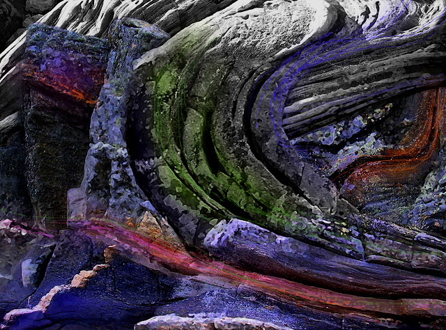
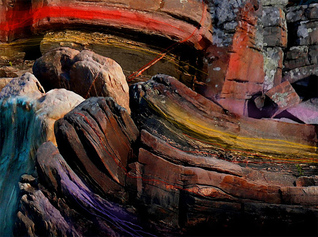
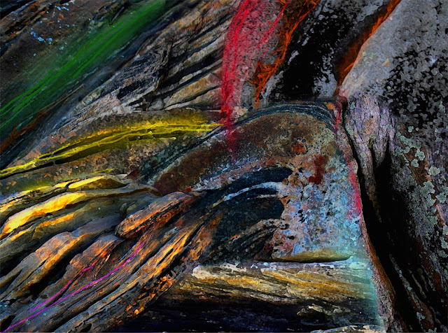
Sourcing the power of their formations
VIDA Fashions by Ted

more of the collection
VIDA Fashions by Ted

Georgian Bay Shoreline Rocks are Wearable
Fashions by Ted

Beautiful Rock and Auto Colours
VIDA fashions by Ted

Georgian Bay Rock Paint Palletts
VIDA FASHIONS by TED

VIDA PILLOW FASHIONS by TED

rock solid pillow talk
Killarney August 2015 "Waters Rising"

West Shore Lambert Is.

44˚ 55' 10. 98" N 79˚ 52' 25. 61" W
Little Pine

44˚ 55' 34 . 83" N 79˚ 50' 23 . 64" W
Lambert Island Channel

Georgian Bay Rocks on

Monument Channel Area

turning up the heat
Caribbean Coral Rocks

GB rocks on

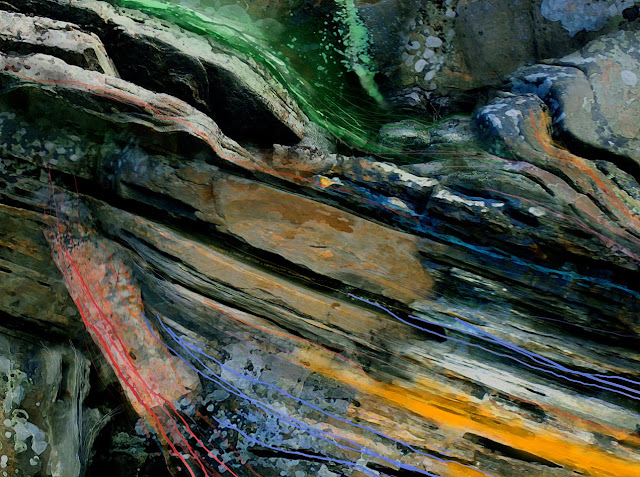
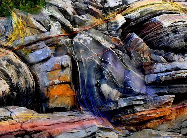
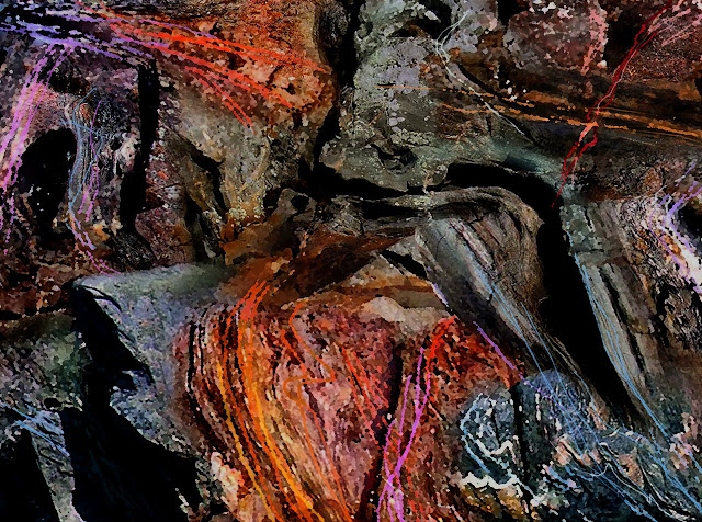
ROCKS TO ART

2014_Maxwell Island, Georgian Bay
Haida Gwaii BC

Balance Rock Beach...All About Pebbles
Rising Tide - Wise Island BC

Pacific Coast Rock Art
Haida Gwaii -Blow Hole Impressions

Tow Hill North Beach
New Book "ROCKS to ART" by Ted Larson

A selection of GPS Prints Available. Go to Blurb.com
44º 54' 58.66" N 79º 50' 33.86 W

Wigwam Island - Artist's Proof © Ted Larson 2011
45˚00' 05.48" N 79˚ 59' 27.99" W

Splitrock Island Area- Artist's Proof © Ted Larson 2011
44˚54' 34.97" N 79˚50' 48.19" W

North Tomahawk Channel - Artist's Proof © Ted Larson 2011
44º 55' 04. 04" N 79º 51' 36. 02" W
South Bone Island - Artist's Proof © Ted Larson 2011
44º 55' 47. 44" N 79º 52' 40. 90" W
Hell's Gate - Artist's Proof © Ted Larson 2011
44º 56' 00. 13" N 79º 51' 30. 87" W
Tabasakwa Island - Artist's Proof © Ted Larson 2011
44º 55' 53. 23" N 79º 52' 38. 96" W
44º 55' 48. 09" N 79º 52' 37. 81" W
44º 55' 56. 03" N 79º 51' 38. 58" W
Tabasakwa Island - Artist's Proof © Ted Larson 2010
44º 55' 24.54 N 79º 52' 35.18 W

Big Ship Island - Artist's Proof © Ted Larson 2011

Artist's Proof © Ted Larson 2011

classic cars become classic art


Flowers to Art

Flowers to Art


