May 15, 2005
Annapolis, Maryland
Navy, Airforce, Police,… we’ve been among all these big gun types since leaving Bellhaven, North Carolina and heading towards Washington D.C. by way of Annapolis, Maryland.
But we’ll back track to renting a car near the Outer Banks known as Cape Hatteras in The Alligator River Marina….
We had hit bad weather so decided to lay up couple days and a side trip by car to Cape Hatteras and The Wright Brothers Memorial and Airfield was required. The lighthouse is the large one they moved away from the sea which was about to consume it with it’s next big wave. To be simple about it, they pushed it down a track at a very slow speed lest it got away on them and trundelled down to the ocean. It was placed to expose the dangers of far out shoals to the many crazy mariners who decide to hike around by the open ocean. This is why it’s known as the graveyard of the Atlantic. Susan was the only one to walk up the many 208 foot high Lighthouse stairs as the rest of us were busy taking pictures, I’m not saying we couldn’t do it, just that other things to do were more important at that time…sitting on a nice bench was one.
We had 60MPH gale force winds recorded at the nearby swing bridge ( they close it down in 35 MPH winds ) the day before going to Cape Hatteras. We were in the safety of Alligator River Marina so next day by car we saw the ocean and beach after being hit by the full fury of the gale the day before. They were shoveling sand off the Outer Banks road with what looked like snow plows. Roads were also flooded as the waves had come up and combined with torrential rains. Of course all the houses and cottages out here are on stilts with their garages below. We prefer our location on Georgian Bay.
Also nearby on the Outerbanks…
The Wright Brothers are another one of those beautiful stories of ..”it can’t be done”…but we’re doing it anyways, so stuff-it to all you experts who bury your heads in the past. On December 17th, 1903 off they went for all of 12 seconds, Orville as the test pilot and Wilbur running along side. Both creating a new world for all of us. A very impressive hilltop monument to these men of flight. They must have always thought their glasses were half full. A special place to mark such a great moment in time and to two great visionary men.
When the weather lifted we headed for Elizabeth City and the start of the Dismal Swamp. Crossed the large Sound of Albemarle, a small roll for 4 hours but ok and docked in their waterfront marina. Sunday shops are mostly closed, sleepy little town. There was a welcome by two elderly folks representing the “Rose Buddies” who used to greet all boaters with roses and a friendly chat. They are now to old so others come and offer wine and cheese at 5:00 PM. So at this gathering we now met and talked with more boaters who are headed north and our Canadian waters.
Going through the Dismal Swamp and its locks was a pretty cruise. This is the oldest and longest operating canal in the USA.( dug by slaves I suspect as it’s straight and deep for a good long haul). Now the Corp of Engineers keeps it that way. We met one of their dredges and waited for them to move over to shore as it’s that narrow. The only wildlife we are seeing are many Osprey hawks in couples on nests built on any dead tree or pole they find.
Coming down the canal we crossed the Virginia border. We arrived in Norfolk,Virginia and many large freighters and warships of all kinds all around. Of course we give way to these boats as they are not known to change course for just a little Canadian.
Had a good stay here and enjoyed visiting the Battleship Wisconsin “Wisky” with David. This ship has quite a history and is still ready for duty if called so we could only walk the decks. The ladies went and did their own sightseeing at the grocery store. Somebody has to do it!.On walking back along the waterfront path we came across another war memorial to the fallen. Took my breath away as this was the most well designed and thoughtful concept to date. Scattered by the wind pieces of paper (bronze plaques). Copies of letters written (during all the various wars since 1776) home to loved ones, written by soldiers that later died in battle. They were laying about in various locations against a wall or in the dirt garden as blown there and could be picked up at any moment and re gathered. As you walk and read these poignant letters you get the message of how terrible wars are. It was a moment not to forget on our trip.
On leaving we were approached by a Canadian warship coming into harbour. Gave them a call on the VHF and made small talk on channel 17 and wished them good sailing and they returned with the same and waved from the bridge. Not to often you get to chat with a Canadian Warship. They did give their name as “Isle de Quebec”. All the the crew were on deck giving salute in uniform but facing shore and the Naval docks as we passed on their starboard.
As we were going out towards sea we were passed by a freighter doing 8 Knots and a US Warship doing 16 knots so we stayed clear once again but we passed another trawler doing 7 Knots while we were doing 9.5. Now all we had to do was get up the Chesapeake to Annapolis. A gray day it was and small waves made the trip a simple run up the bay…
but once again…
We saw a strange 30 foot yellow boat with numbers 903 and a red tower of lights, curious, I called him onVHF 16 and switched to 17, the response was…..”we are a beacon for lining up the targets you see ahead of you as you are in a restricted area for airforce target practice…..but for now you are ok going onwards”…So on we went and as we are passing these unusual umbrella looking targets a patrol boat with flashing lights comes our way and suggests by VHF radio we go east 1 1/4 mile off our northern route and once again we do as we are told cause we are such nice courtesy type boaters.
(We knew by our charts this was a restricted area but there had been no advance warning on our VHF and you can travel through these areas. We were not the only ones that had to be moved to the east)
Later saw some impressive jets playing high above us but did not witness or hear the target runs.
Coming into Annapolis was a thrill as it’s the home of The USA Naval Academy and the harbour is jammed with all types of boats mostly sail though. We have all our flags flying including the latest of Maryland. A great little town of shops and restaurants.
Well, we have our rental car and now are off to Washington D.C. The streets are filled with police in and out of uniform from everywhere. All wear their gold shields around their necks. Guess what?, seems we’ve landed here during a weekend when a special memorial dedication to the nations police who have died in line of duty. We saw the Presidential Limo and 6 police car escort flying down the street to attend this event at the Capitol Building. Every police car and motorcycle in the USA seems to be here, wondering who’s watching the shop back home?
Had to see the new Smithonian Museum of the American Natives. This was worth the trip as it made very clear the current vibrant Renaissance and the past stormy history of their continuing existence. Many beautiful exhibits of art and objects both new and ancient. It includes many tribes not too well known from Southern Chile to our own Northern Inuit. I recommend this as a good destination of learning. To top this Pat and I went back Sunday to do the War Memorials. The Viet Nam Memorial, Korean and others here are mind bending. To get lightened up a little I took off for the Gallery of Art to see the Toulouse and Montmarte exhibit, a special look into this man’s monumental works and his very brief life, dying at 36. By the way forgot to mention lunch in a Spanish Restaurant of tapas roasted duck and next day of French Normandy soft shell crab Provencale. Things are goo…oo…ood.
Not sure whether food for thought or food for nourishment is better. Certain we need both to carry on our fabulous loop journey.
Eating and pondering….. Loopers…Ted, Pat, David and Susan
NEW BOOK!

Boating Ahoy!
VIDA_GLASS TRAYS by TED

VIDA FASHION MATS

Georgian Bay Shadows

Georgian Bay Waters Edge

2018 Day trip to the outside island
Fall Carpet

Georgian Bay comes alive
salt spring island shores

48˚ 55' 20.98" N 123˚ 33' 07.82" W
VIDA Fashion Statement Bags

good quality with unique styling
VIDA FASHIONS by Ted

New Statement Bags
aluminum art images

cars and flowers
Georgian Bay near McCrae Lake

Sourcing the power of their formations
VIDA Fashions by Ted

more of the collection
VIDA Fashions by Ted

Georgian Bay Shoreline Rocks are Wearable
Fashions by Ted

Beautiful Rock and Auto Colours
VIDA fashions by Ted

Georgian Bay Rock Paint Palletts
VIDA FASHIONS by TED

VIDA PILLOW FASHIONS by TED

rock solid pillow talk
Killarney August 2015 "Waters Rising"

West Shore Lambert Is.

44˚ 55' 10. 98" N 79˚ 52' 25. 61" W
Little Pine

44˚ 55' 34 . 83" N 79˚ 50' 23 . 64" W
Lambert Island Channel

Georgian Bay Rocks on

Monument Channel Area

turning up the heat
Caribbean Coral Rocks

GB rocks on

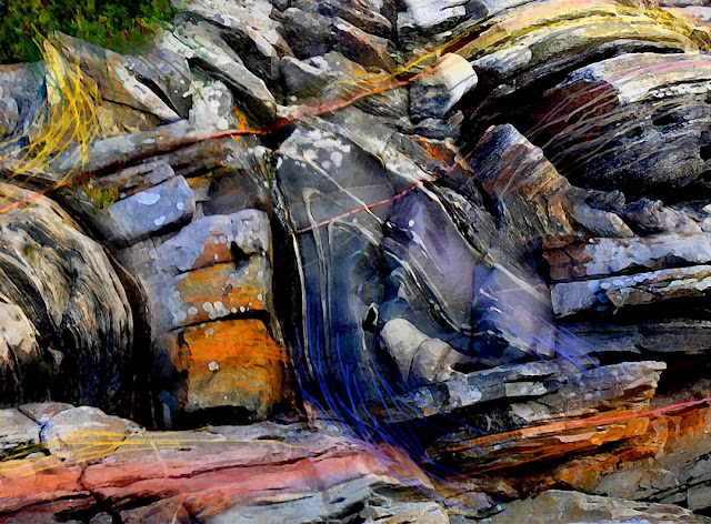
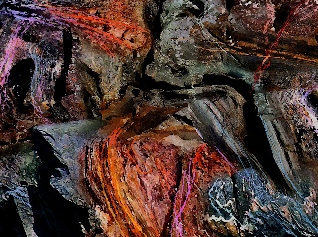
ROCKS TO ART

2014_Maxwell Island, Georgian Bay
Haida Gwaii BC

Balance Rock Beach...All About Pebbles
Rising Tide - Wise Island BC

Pacific Coast Rock Art
Haida Gwaii -Blow Hole Impressions

Tow Hill North Beach
New Book "ROCKS to ART" by Ted Larson

A selection of GPS Prints Available. Go to Blurb.com
44º 54' 58.66" N 79º 50' 33.86 W

Wigwam Island - Artist's Proof © Ted Larson 2011
45˚00' 05.48" N 79˚ 59' 27.99" W

Splitrock Island Area- Artist's Proof © Ted Larson 2011
44˚54' 34.97" N 79˚50' 48.19" W

North Tomahawk Channel - Artist's Proof © Ted Larson 2011
44º 55' 04. 04" N 79º 51' 36. 02" W
South Bone Island - Artist's Proof © Ted Larson 2011
44º 55' 47. 44" N 79º 52' 40. 90" W
Hell's Gate - Artist's Proof © Ted Larson 2011
44º 56' 00. 13" N 79º 51' 30. 87" W
Tabasakwa Island - Artist's Proof © Ted Larson 2011
44º 55' 53. 23" N 79º 52' 38. 96" W
44º 55' 48. 09" N 79º 52' 37. 81" W
44º 55' 56. 03" N 79º 51' 38. 58" W
Tabasakwa Island - Artist's Proof © Ted Larson 2010
44º 55' 24.54 N 79º 52' 35.18 W

Big Ship Island - Artist's Proof © Ted Larson 2011

Artist's Proof © Ted Larson 2011

classic cars become classic art


Flowers to Art

Flowers to Art


